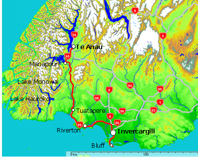
Journey time: 3 hours (192km Te Anau to Invercargill
including lunch on the beach at Riverton and several photo stops)
Direct via SH6 (152km) would be 2h:10m
Weather: Fine and warm (Te Anau 29°C, Invercargill 22°C)
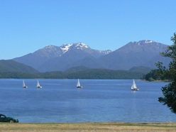
Once again we are blessed with more magnificent weather. This is our 17th day on the road (including six days in Queenstown) and every one near perfect - not something you can depend on, but we'll happily take it.
A gaggle of yachts are gliding their way around Lake Te Anau as we visit the Te Anau Golf Club on our way out of town.
Really like Te Anau. Sorry to go, but will be back!
Today we head for the very bottom of the South Island. From Te Anau we travel South toward Manapouri again and follow the Scenic Highway past signs pointing to Lake Monowai and Lake Hauroko (note to self to visit these places next time) and through Tuatapere to the South Coast.
The road has been relatively recently completed and is of excellent quality. Very little traffic. The scenery is typically rural New Zealand and a very pleasant drive with some great outlooks and viewing points along the way.
On one straight stretch there was obviously something in the middle of the road ahead - some item of roadkill from the night before, probably a possum. As we got closer, something moved. Up reared the biggest bird I'd ever seen - probably a Kahu (harrier hawk) - must have been a metre or more across as he/she spread its wings to get airborne just as we swerved and stopped to take a photo (too quick for the camera, alas). Made the heart pound faster though.
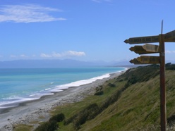
The coast was a magnificent sight. The water surprisingly turquoise, the beach extended for miles. Almost tempted to clamber down a sandhill and test the water. Bound to be cold with a treacherous undertow though.
The land, whilst well covered in grass, is desolute of any higher vegatation with the few surviving trees bent in the direction of the prevailing southerly wind.
On the horizon to our right is the Hump Ridge (another must do Track for next time) and the southernmost mountain ranges of the Fiordland National Park.
Followed the coast round to Riverton. Absolutely stunning on a day like today. Watched little fishing boats and pleasure craft come and go in and out of the river mouth. Relaxed with lunch on the beach.
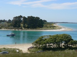
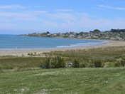
After a paddle, forced ourselves on to Invercargill. With a population of a whopping 50,000, it's the biggest place we've seen for a couple weeks.
Next day we checked out the ocean beach and sand dunes at Oreti before making our pilgrimage to the South Island's most southerly town of Bluff.
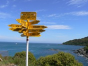
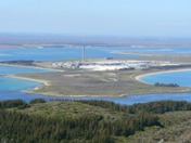
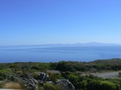
At last we've seen for ourselves the famous signpost that marks the end of State Highway 1 - a great kiwi icon. There's a nice short walk around the coast here with views of Tiwai Point, Stewart Island (maybe on the far horizon) and the occasional fishing boat chugging by (Foveaux Walkway). Or you can clamber up the hill above the signpost for a more elevated outlook (Topuni Track).
But the best view of all is from the very top of Bluff Hill. Walkers can reach this by keeping going up the Topuni Track for 50 minutes or the more sedentary like me on this day, can drive up from one of the side roads signposted in the township. Be sure to get up there one way or another.
